CURRENT PROJECTS


Eons "The Flow" Bike Park, Eons Adventure Park

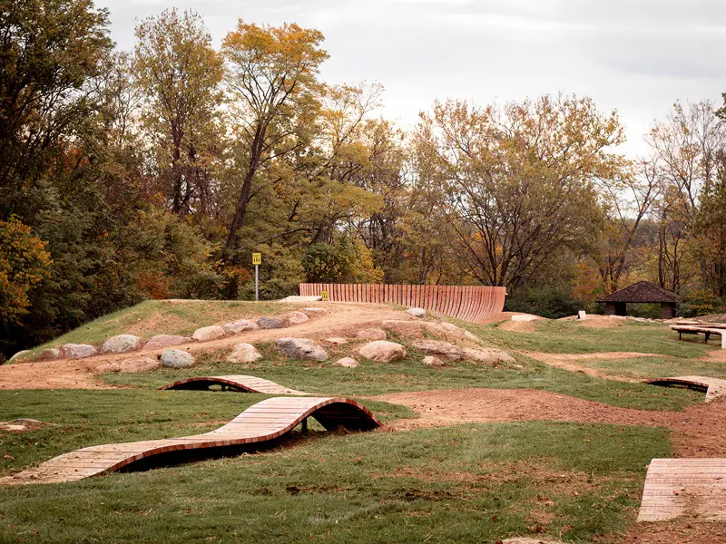
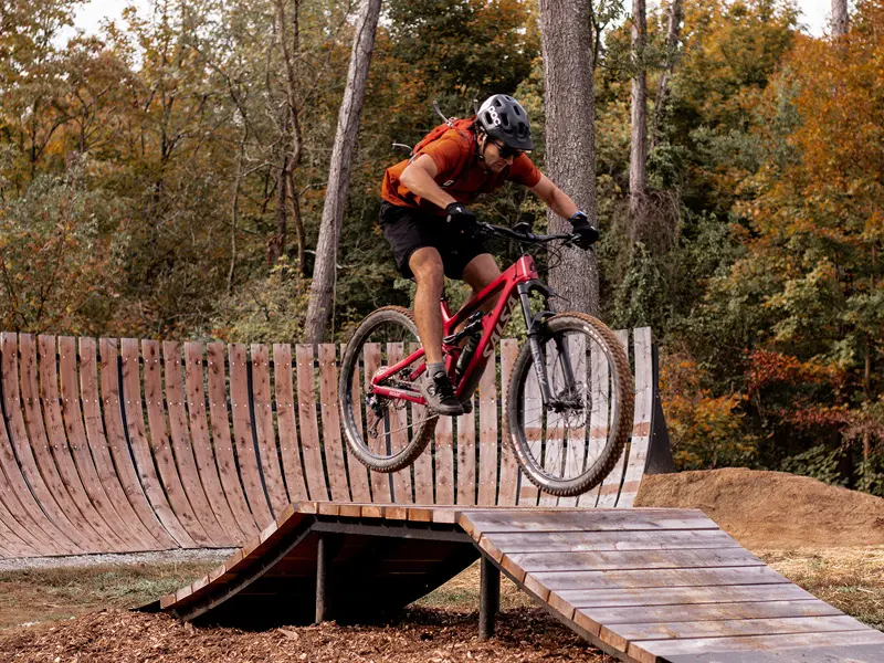
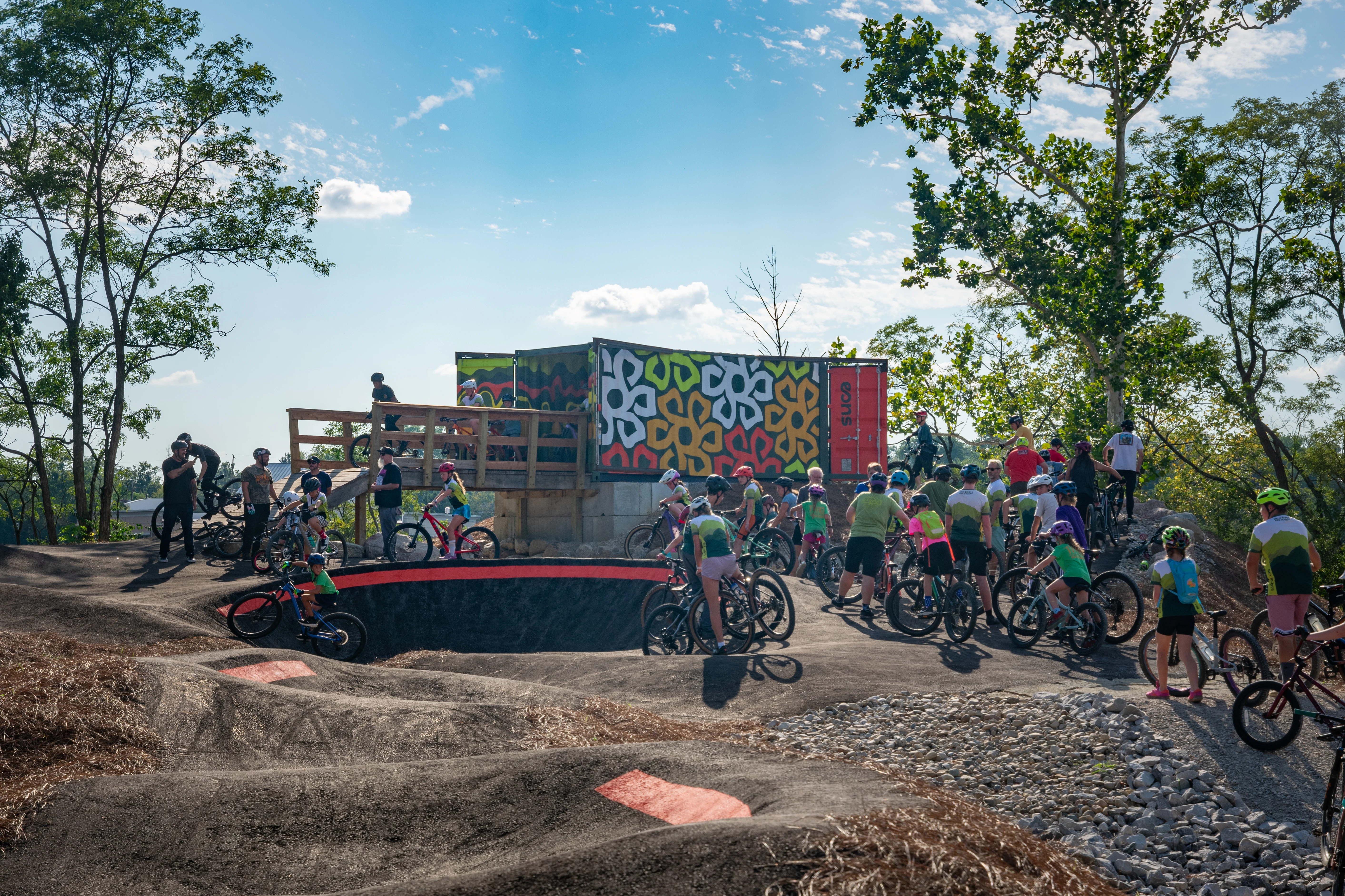
UPDATE: The first phase of EONS Park trails is complete, with "The Flow", a progressive bike park. Work is being constructed by Innovative Dirt Solutions. Go enjoy the new bike park!

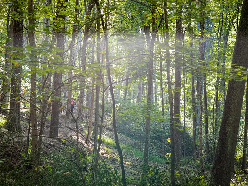
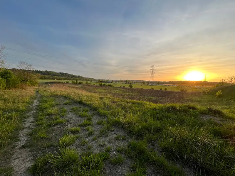
Eons is a planned 1,000-acre adventure park located in the urban woodlands of Erlanger, Kentucky, where all generations can wander, play, learn, escape, and explore forever. Just minutes from CVG Airport and the I-75/71 corridor, Eons Park will be a premier destination for world-class trails and outdoor recreation. Nestled in the Dry Creek valley, the park will open with a dog park, a bicycle playground, and several miles of trails near Donaldson Highway and Houston Road, funded and slated for bid in October 2025. Future access under I-275 at Turfway Road will reveal the sweeping views and elevation of the lower valley. For residents and workers nearby, Eons will be a daily escape into nature; for the region, it will preserve nearly 1,000 acres of landscape for generations.

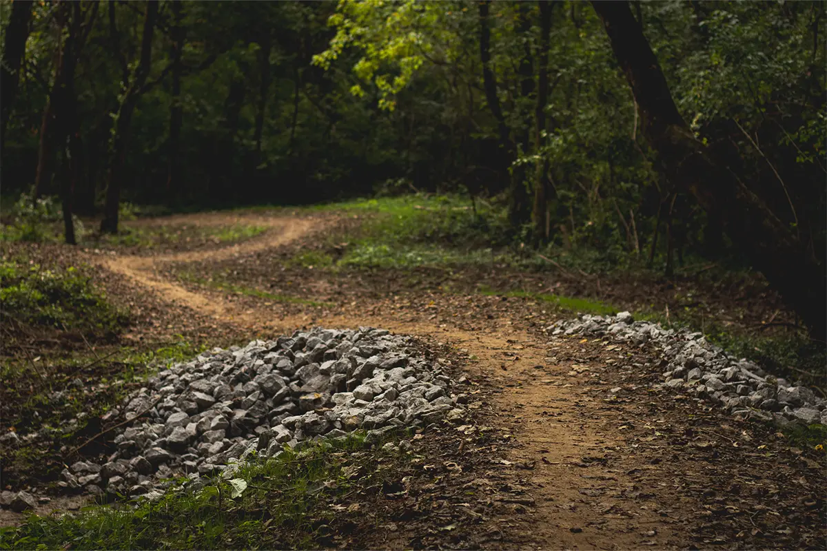
Innovative Dirt Solutions, the firm that recently built the Mt. Airy Skills Course for Progressive Bike Ramps, will construct the first trails and  bike park on property near the Cherry Hill neighborhood. Phase I includes 2 to 3 miles of natural-surface trail. As phases unfold, the park will grow into a regional trail hub, with planned connections to Devou Backcountry Trails and beyond, making Eons a truly connected adventure destination.

Eons Park "The Flow" Bike Park

Project Partner

City of Erlanger Logo

Northern Kentucky Regional Trails Plan

Imagine stepping outside your door in Covington and seamlessly traveling a connected network of trails linking seven cities, three counties, and Northern Kentucky’s most iconic destinations. The NKY Regional Trails Project is turning this vision into reality, building a safe, accessible system of paved and natural-surface trails for residents and visitors alike. Trails strengthen communities by connecting people to places and each other. Building on Riverfront Commons as the backbone, the plan will link destinations such as Devou Park, the Purple People Bridge, Kenton County Park, and Eons Park, expanding opportunities for recreation, tourism, and business growth across the region.

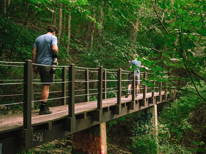
Northern Kentucky Bridge Trails Photo

What’s Coming:

Initial Buildout: Activate 30 miles of trails within the first 24 months

Regional Connectivity: A master plan with 70+ stakeholders is aligning cities and counties to create seamless, cross-boundary trail connections

Community Impact: Safer, more accessible pathways for walking, biking, and exploring will improve quality of life, boost local economies, and expand recreational opportunities for all

Planning & Initial Buildout: Launch a regional master plan, then connect 30 miles of paved trails, quiet streets, and natural-surface trails within the first 24 months

Project Partner

Tri-State Trails Logo

OneNKY Connector

The OneNKY Connector is Northern Kentucky's urban trail network connecting our paved multi-use paths and natural surface trails to the places we live, the outdoors we love, and the region we all share. Built for bikes, feet, and fresh air, it connects us all and moves us forward together.

The Connector introduces a cohesive wayfinding system across 7 NKY cities over 37+ miles of pedestrian and rider-friendly roads and pathways, linking people to key destinations throughout the region: 12 business districts, 22 schools, 5 grocers, 17 parks & 5 proposed parklets (“Bike Hubs”), 50+ miles proposed and planned trails, 7 planned developments & infrastructure improvement projects, dozens of civic and cultural destinations

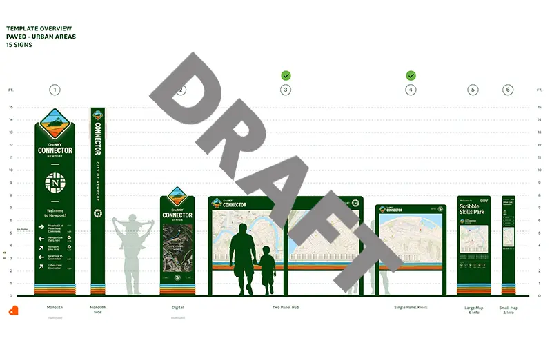
OneNKY Connector Signage Draft

Northern Kentucky already has many miles of bikeable and walkable streets, but today, most people don’t know where they go or how they connect. Our cities have good bones and supportive infrastructure, but they feel disconnected. Connections are unclear between nearby, existing assets. Wayfinding assistance is the key to connection while infrastructure is planned, funded, and built.

Covington

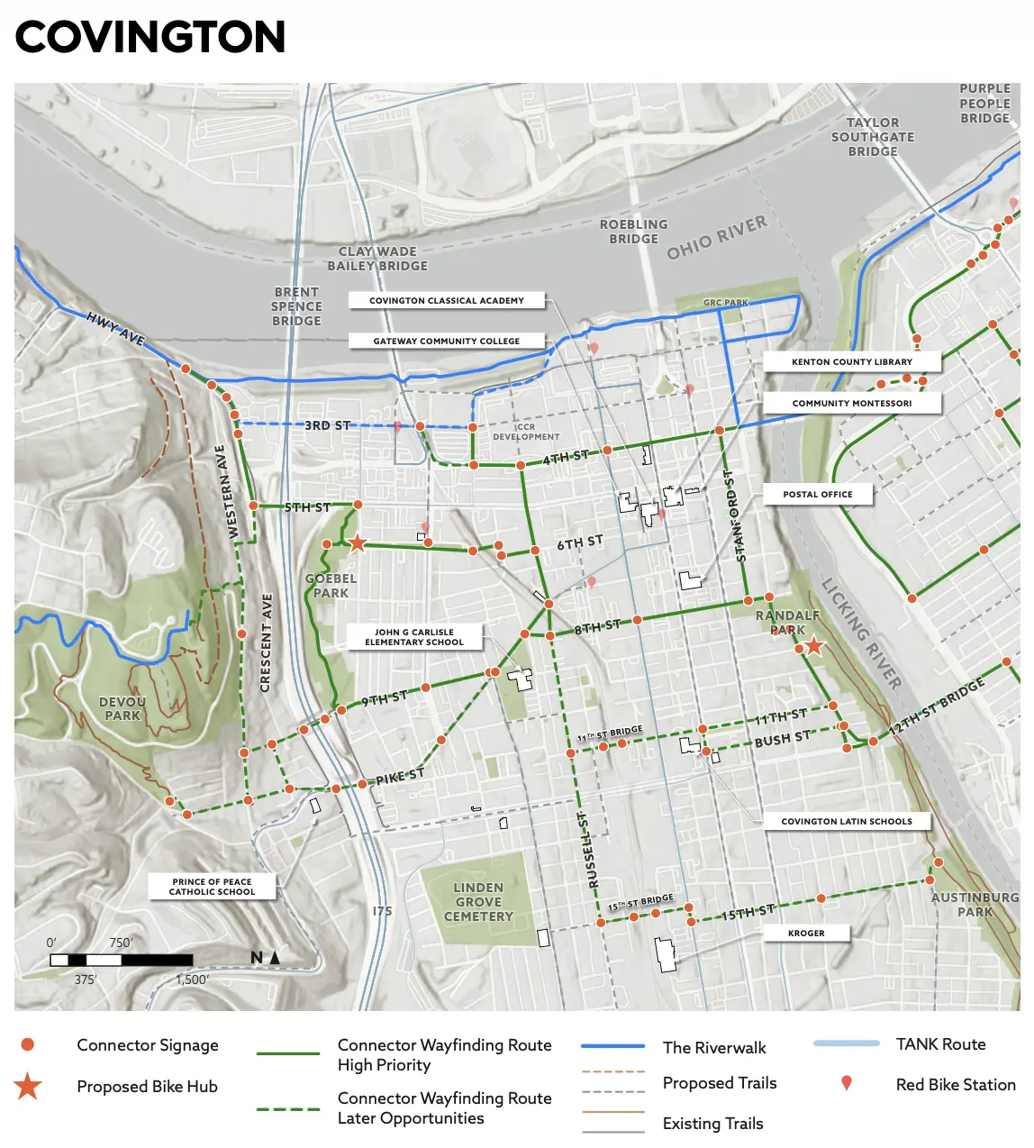
The route winds through Covington’s complex urban road network, passing through Mainstrasse Village and the anticipated Covington Central Riverfront development while connecting key civic destinations like grocers, schools, cultural landmarks, parks, libraries, and post offices. The route takes advantage of four bridges: the 11th Street Bridge, the 12th Street Bridge, the 15th Street Bridge, and later phases will include shared use paths with the reconstruction of the 4th Street Bridge. Planned right- of-way expansions and future bike and pedestrian infrastructure related to the Brent Spence Bridge project are also included.

OneNKY Connector Covington

Newport

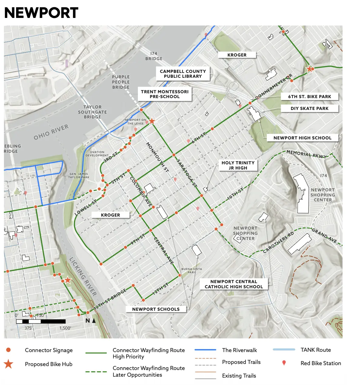
The Newport segment links some of the city’s most active and frequented destinations, including the new Kroger, the Ovation mixed-use development, Buena Vista Park, and General James Taylor Park. The route connects residents to Newport Schools and the Campbell County Public Library, reinforcing the network’s role as a practical transportation corridor for daily needs. The alignment is strengthened by planned bike and pedestrian infrastructure, with later phases incorporating improvements to the 4th Street Bridge, enhancing regional connectivity across the Licking River corridor.

OneNKY Connector Newport

Bellevue

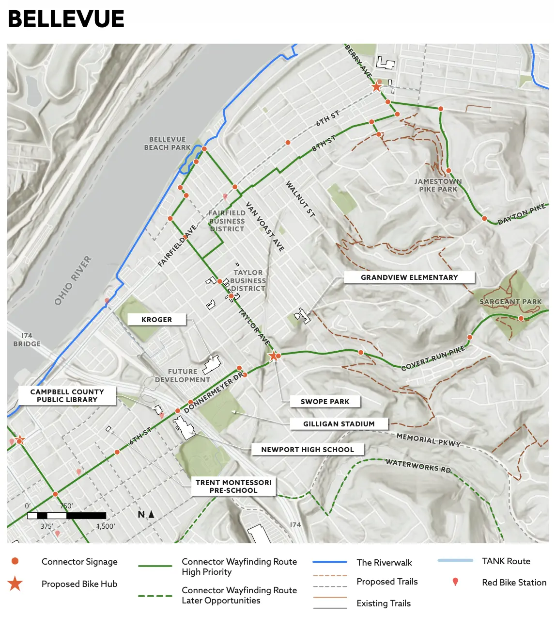
The Bellevue segment continues out of Newport along 6th Street and Donnermeyer Avenue, linking everyday destinations and neighborhood assets. The route connects residents to grocers, and the Fairfield Avenue and Taylor Avenue business districts, making it a practical option for daily errands, and providing connections to recreational assets like Bellevue Beach Park and Sargeant Park. Planned bike and pedestrian infrastructure, alongside anticipated mixed-use developments and right-of-way expansions along the corridor, position this segment for significant near-term improvement and reflect strong local momentum for active transportation investment.

OneNKY Connector Bellevue

Dayton

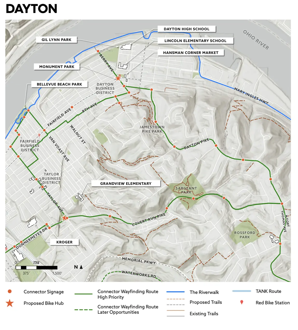
The Connector passes through the heart of Dayton, linking business districts and Dayton Schools with neighborhood green spaces including Jamestown Pike Park and Gil Lynn Park. The route also connects to the Manhattan Harbor development, a significant mixed-use waterfront project that reinforces the Connector’s role in linking active transportation infrastructure to the region’s most dynamic areas of growth and investment.

OneNKY Connector Dayton

Fort Thomas

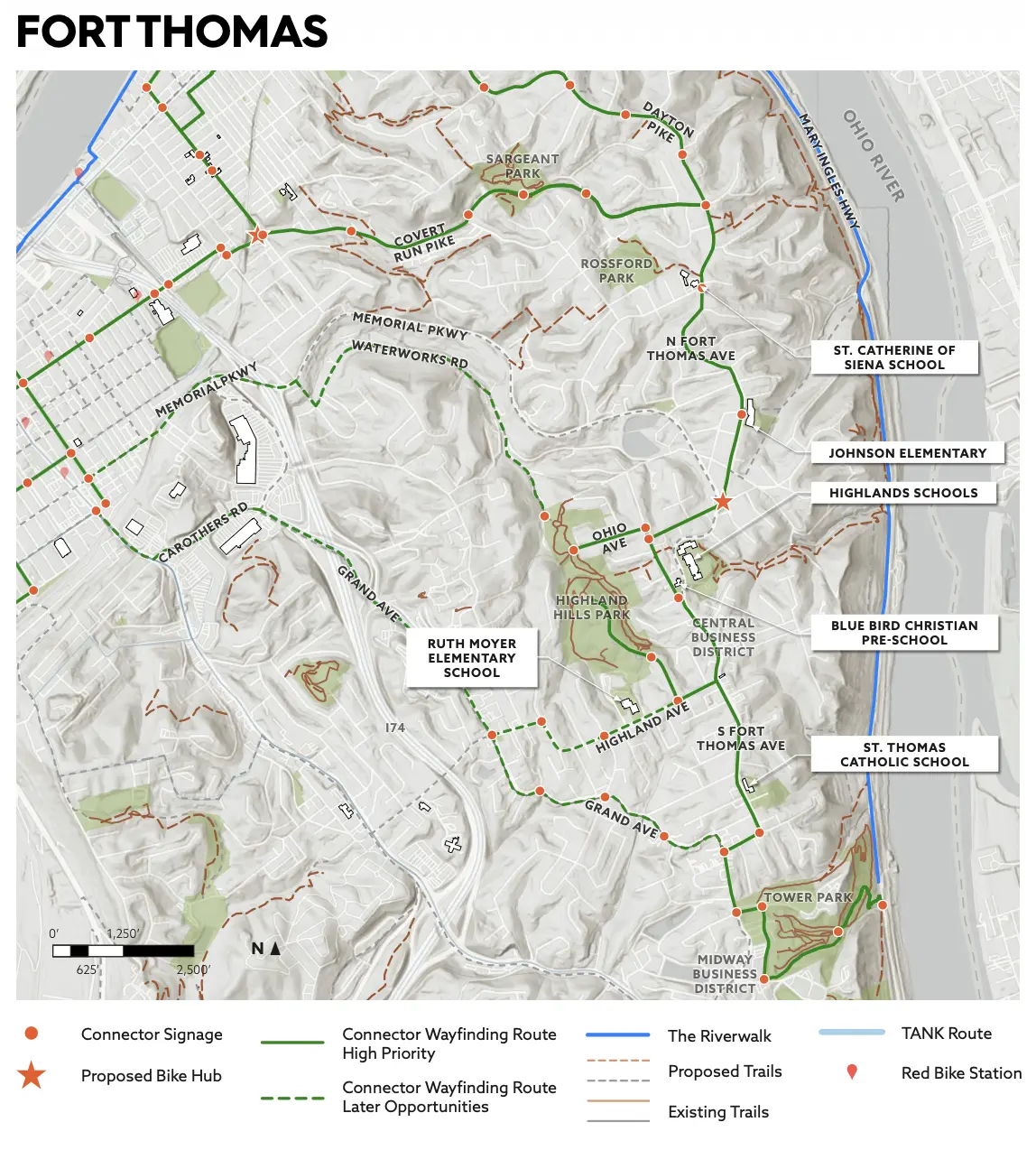
Fort Thomas serves as the eastern terminus of the route. The Connector links two of the city’s primary commercial nodes, the Fort Thomas Central Business District and the Midway Business District, alongside several Fort Thomas Schools, priming the corridor for student pedestrian and cycling activity. The route also connects to Highland Hills Park with Tower Park, providing recreational access and reinforcing Fort Thomas’s strong identity as a walkable, amenity-rich community.

OneNKY Connector Fort Thomas

Goals of the Connector

Create safe, intuitive routes to key destinations by leveraging existing infrastructure and strengthening wayfinding.

Increase walking and biking participation by promoting health, wellness, and a vibrant outdoor culture through visible, accessible facilities.

Build long-term momentum for active transportation through placemaking strategies, Bike Hubs, and collaborations with local leadership.

Support multimodal transit options in Northern Kentucky to better serve local communities, and help promote NKY as a regional destination.

Project Partners

OneNKY Alliance
Dewhaus

Clear Creek Bike Park

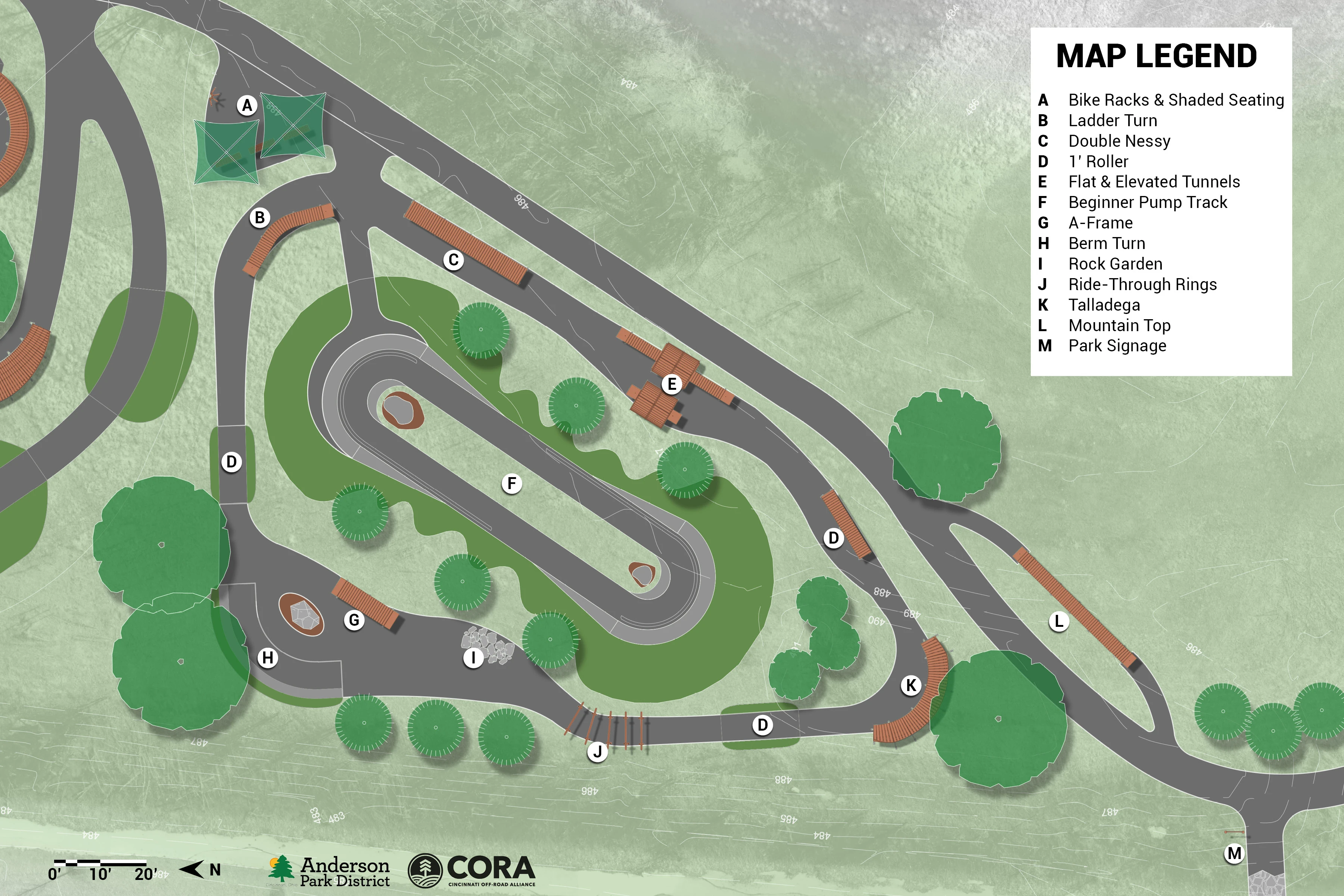
Clear Creek Bike Park, located on the Little Miami Trail Corridor and Route 32 in Anderson Township, will be open to all: toddlers on striders, teens, adults, adaptive athletes, and first-time riders. With progressive features for every ability level, the park breaks down barriers to recreation. It brings youth into nature, offering a healthy path toward belonging, movement, and growth. Phase I ensures access for riders of all ages and abilities. Phase II adds higher-skill jump lines and technical features, an intentional outlet for teens and adults who seek risk and adrenaline.

Bike parks give young people safe, welcoming spaces to explore, take risks, and grow. On two wheels, they build skills, confidence, and resilience. By making outdoor recreation fun and accessible, bike parks help fight inactivity, reduce isolation, and strengthen well-being.

Clear Creek Bike Park Rendering

What’s Coming

Progressive Flow Trails: All-weather, low-maintenance paved trails designed for every skill level, inspired by successful bike parks like the Dayton Bike Yard

All Wheels Welcome: Built with bikes in mind, the park will also be open to adaptive equipment, one-wheels, skateboards, and other appropriate wheeled uses

Community Access: Located along the Little Miami Corridor near Route 32, the park will be easily accessible for neighborhood families, youth programs, and regional visitors

Phased Construction: Environmentally sensitive building methods and durable materials will ensure long-term sustainability, with features added in phases as funding becomes available

Why It Matters: Bike parks are more than recreation, they shape healthier lifestyles, reduce inactivity, and create welcoming spaces where youth and families can connect. By breaking down barriers to outdoor activity, Clear Creek Bike Park will empower the next generation to move, play, and thrive through transformative outdoor experiences

Project Partner

Anderson Park District Logo

Goltra Preserve

CORA, Groundwork Ohio River Valley, The Hillside Trust, and the East Westwood Improvement Association are partnering to bring over 3 miles of professionally designed natural surface trails to Hillside Trust–preserved property between Brokaw and Montana Avenues. These trails will connect directly into the neighborhood and sit just minutes from the Mt. Airy mountain bike trails. As the Mt. Airy Skills Park moves forward, future connections will make it even easier for families to access both trail systems.

East Westwood is a historically underserved community with limited access to greenspace and safe recreation. The Goltra Trails Project is designed not only to provide trails but also to strengthen the neighborhood by creating pathways to opportunity. Alongside new trails, the project will support training programs that provide certifications in trail building, chainsaw use, and other trades. These are skills that community members can carry into the workforce.

This will transform East Westwood by creating safe, accessible outdoor space and workforce development opportunities in a community with high need and few connected pathways. This project will improve health, expand recreation, and provide skills that help residents find jobs, all while connecting to a broader trail network and giving the neighborhood a trail system to call its own.

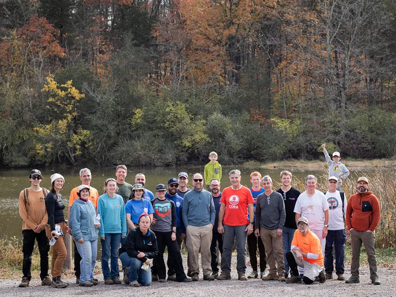
Goltra Preserve Trail Day Photo

What’s Coming:

Neighborhood Connectivity: Trails that reconnect neighborhoods divided by I-74 and link to the future CROWN trail network

Multi-Use Access: Safe, sustainable trails designed for walking, biking, adaptive cycling, and family use

Community Investment: Training and certification opportunities, mentorship programs, and volunteer pathways to help residents build skills and strengthen resumes

Equity & Health: Expanding access to greenspace where it’s most needed, supporting physical activity, mental health, and environmental education

Sustainable Design: Durable, low-maintenance trails built with environmentally sensitive methods

Project Partner

The Hillside Trust Logo

Little Miami River Valley Outdoor Recreation Corridor

CORA, in collaboration with Great Parks, Cincinnati Parks, Anderson Township, Anderson Park District, Hillside Trust, City Of Cincinnati Government, and Cardinal Land Conservancy, has partnered with Applied Trails Research to bring the region’s first large-scale, multi-ownership natural surface multi-use trail to life. Led by trail experts Dr. Jeremy Wimpey and Scott Linnenburger, the team has completed an opportunity study for the Little Miami Natural Surface Trail Corridor, bringing world-class, sustainable trail design to our area.

This feasibility study, made possible by The Harold C. Schott Foundation and United Dairy Farmers, outlines some exciting benefits: expanding recreation opportunities in the Little Miami River valley, utilizing the paved greenway system as a backbone to link natural surface trails and river access points, and providing new ways for families and outdoor newcomers to experience our natural assets. Additionally, this project will offer bike-friendly access close to downtown, serving underrepresented communities in Cincinnati.

Clear Creek Bike Park Future Site Photo

With plenty of trailhead parking and conserved land connected along the river, this project will significantly boost recreational access across the region, without the need for a car. While it will take a few years to fully implement, partners are already making progress, with initial sections underway and complete at Avoca Preserve, Great Parks, and Columbia Township.


Caeser Creek State Park Mountain Bike & Hiking Trails

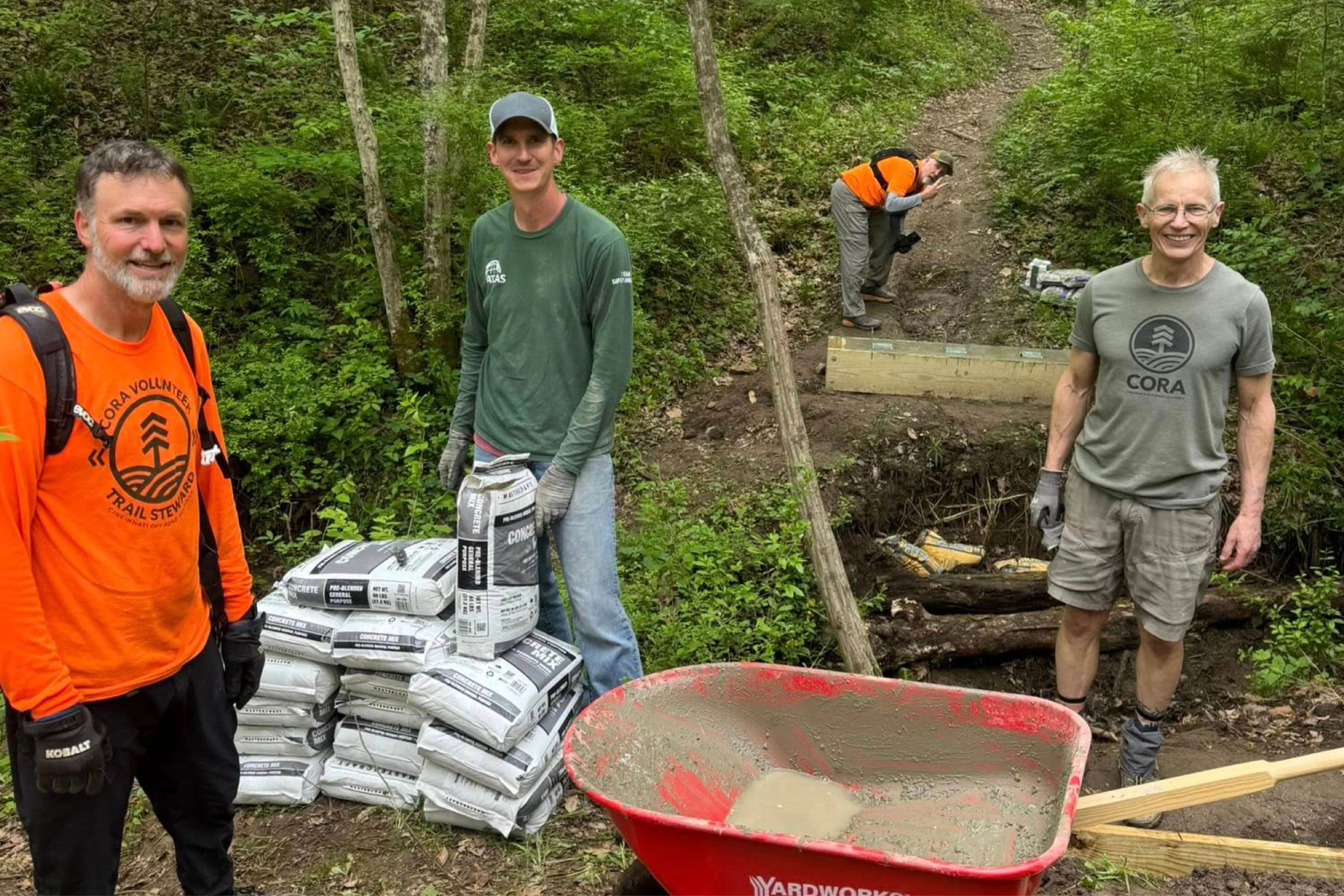
The CORA Trail Crew and Caeser Creek’s devoted volunteers and trail stewards have been hard at work reinforcing bridges! They moved all the wood for a 20’ bridge, including the usage of the CORA mud buggy. They also moved 20 60# bags of concrete, set forms, and poured footings. It took nearly 70 hours of volunteer work to complete the project! It’s really inspiring to see a community come together to make a difference for a multitude of trail users!

Caeser Creek State Park Mountain Bike Trail Bridge Repair

Photo courtesy of Caeser Creek MTB and Hiking Trails

🔗 Learn more about this project.

Project Partner

Ohio Department of Natural Resources Parks & Watercraft Logo

Harbin Park Trail Refresh

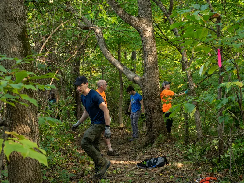
These trails have long been a local resource for outdoor recreation, but overgrowth, downed trees, unclear signage, and unsafe features have made parts difficult or frustrating to use. With a community-driven effort and support from CORA and the City of Fairfield, we’re improving the trails to welcome all ages and skill levels.

Harbin Park isn’t just about trails, it’s about connection to nature, to neighbors, and to physical and mental health. By improving these trails, we’re making it easier for more people to get outside, breathe fresh air, enjoy exercise, and relieve stress, all close to home. It’s also a chance to build stronger stewardship in Fairfield by engaging volunteers, creating a shared sense of ownership, and ensuring this green space thrives for years to come.

Harbin Park Trail Day 2025 Photo

What’s Happening:

Regular volunteer trail-days for work like clearing roots, removing blockages, brushing, and tread work

Clearer signage, safer trail navigation, and maintenance routines so the experience is reliable and fun

Reinforcing trails with sustainable design practices to prevent erosion and ensure long-term access

Trail Partner

Fairfield Parks and Recreation Logo

Stonelick State Park Trail Work

Update: ODNR will be using Recreational Trails Program funding to complete the next phase of the project which will go out to bid in the fall of 2026, with construction expected to finish in 2027.

CORA began building new trails at Stonelick State Park in 2023 to expand recreation along the campground and lakeside. In spring 2025, progress stopped when the AmeriCorps program was canceled. Although progress was halted, the vision for a sustainable, connected trail system is mapped, designed, and ready for construction.

Stonelick’s trails were originally routed along property lines, which created drainage and erosion challenges. The new design establishes a 9.4-mile sustainable trail around the lake and campground, improving durability, reducing maintenance, and providing long-term stability. These trails will open access for hikers, bikers, and families while strengthening tourism and recreation in underserved Clermont County communities.

Stonelick State Park Trail Volunteers

The loop will connect campers directly to Edenton. Families will gain safe access to fishing spots, nature exploration, and a healthier campground experience, all while opening new opportunities to revitalize the historic schoolhouse and strengthen Clermont County’s regional appeal.

Project Partner

Ohio Department of Natural Resources Ohio State Parks & Watercraft Logo

COMPLETED PROJECTS


Landen Deerfield Park

Trail renovations are complete at Landen Deerfield Park in Landen, Ohio! These are flowing nicely and welcome to ride, featuring a new flow jump line to progress your skills! Perfect for beginner riders looking to get into mountain biking, with beautiful scenery and creek crossings, providing a canopy for hikers and runners alike. Trails updated by Innovative Dirt Solutions and Backwoods Trail Company.

These updates will reduce erosion, improve drainage and sustainability, enhance safety for trail users, improve navigation, while creating an environment for new riders. Many of the trails required consistent maintenance in their previous state, and these updates reduce manual wear and tear. Built to last, these trails will invite our trail users throughout the community. This project is funded by a grant from the Ohio Trails Partnership through ODNR (Ohio Department of Natural Resources). This renovation project has begun construction, and they will be ready for the public to use upon completion. For now, do not use the trails as the trail builders do their magic to make them last for years to come!

Landen Deerfield Trail Upgrades 2026

Landen Deerfield Park in Landen, Ohio, is set to become a stronger part of Greater Cincinnati’s growing trail network. By improving its multi-use trails, this project will boost community quality of life, attract new talent to the region, and expand outdoor recreation opportunities for all. The park is home to some of the region’s first mountain bike–accessible, volunteer-built multi-use trails. Today, hikers, runners, and cyclists share these routes, but aging design and erosion challenges limit the trails’ sustainability and user experience. An updated plan will bring the system in line with modern trail standards, balancing sustainability, accessibility, and recreational value. Enhancing Landen Deerfield Park’s trails strengthens Cincinnati’s vision to become a trail-based recreation destination. The improvements will provide safer, more enjoyable trails for families, runners, hikers, and mountain bikers while ensuring a sustainable trail system for future generations.

The trail update features:

Multi-Use Flow Trails: Mountain bike-optimized beginner and intermediate trails designed for fun, flow, and sustainability

Family-Friendly Access: A new creek access trail for hikers, bikers, and families to explore

Trail Decommissioning: Closing old, unsustainable routes to prevent erosion and protect the park’s natural environment

Upgrades for the Future: Redesigned alignments and improved construction techniques to ensure long-term durability and low maintenance

acessibility for all riders and visitors

Project Partner

Warren County Park District Logo

Mt. Airy Bike Skills Course

CORA, in collaboration with the Cincinnati Parks Foundation and Cincinnati Parks, is proud to support the opening of the Mount Airy Bike Skills Park. This project was designed with Progressive Bike Ramps, a national leader in creating inclusive bike facilities, and constructed by Innovative Dirt Solutions.

Located centrally in Mount Airy, this urban site offers easy access for residents across the city and presents a unique opportunity to engage an underserved and diverse community. CORA and our partners are grateful for the community’s interest and energy in making this vision a reality. Together, we’re building a new gateway for riders of all ages and abilities to experience the joy of trails.

Mount Airy Bike Skills Park

The new park features:

A perimeter flow trail designed for riders of all levels

A skills area with progressive obstacles to help riders build confidence

Adaptive-friendly design so riders of all abilities can participate

An ADA-compliant concrete pathway along the skills area, ensuring accessibility for all riders and visitors

Project Partners

Cincinnati Parks and Cincinnati Parks Foundation Logos

Mitchell Memorial Forest Bike Skills Course

Great Parks of Hamilton County added a skills course and skills loop to its existing 8-mile mountain bike trail at Mitchell Memorial Forest. This is the first official trail of its kind in Hamilton County. With progressive features for every skill level, the new bike park will give riders a place to build skills, gain confidence, and have fun on two wheels. 

CORA and Great Parks of Hamilton County had the opportunity to talk with @jketchmark with WCPO News about the new Mitchell Memorial Forest Bike Skills Course and Loop which officially opened on November 1st, 2025.

Mitchell Memorial Forest Bike Skills Course

Big moves for mountain biking and trails in Cincinnati, and we’re just getting started.

🔗 Learn more in this Local 12 article.

Project Partner

 Great Parks Logo

Avoca Loop

CORA partnered with Great Parks of Hamilton County to bring a new mountain bike loop to the Little Miami Scenic Trail at Avoca Park in Cincinnati. The Avoca Loop adds a fun, beginner-friendly riding option right off the popular paved trail, giving families and new riders a safe and exciting way to explore mountain biking.

The Little Miami Scenic Trail is one of the region’s most beloved greenways, but until now it offered few opportunities to get off the pavement. The Avoca Loop introduces natural-surface riding in a convenient location, expanding access to outdoor adventure for all ages and skill levels. The Avoca Loop is a small but powerful addition to Greater Cincinnati’s trail network. It helps introduce new riders to mountain biking, supports Great Parks’ commitment to recreation and conservation, and strengthens the case for more natural-surface trail opportunities across the region.

Avoca Loop off of the Little Miami Trail

What It Offers:

Beginner-Friendly Loop: A safe, approachable way for new riders to try mountain biking

Trail Access: Directly connected to the Little Miami Scenic Trail at Avoca Park

Family Fun: A short, accessible loop designed for kids, families, and anyone curious about riding dirt

Trail Partner

Great Parks Logo

Sargeant Park

CORA partnered with the City of Dayton and local community groups to help restore this wooded park on Covert Run Pike. Improvements include new and improved trails, upgraded buildings, better signage, and enhanced accessibility, making the park more welcoming for hikers, bikers, and nature lovers.

Sargeant Park

🔗 Learn more via this LINK NKY article about the reopening and improvements.

Why It Matters:

Revitalizing Sargeant Park strengthens outdoor access in Dayton and supports equitable recreation

The upgrades boost neighborhood quality of life and encourage more people to explore nature locally

Project Partner

City of Dayton Kentucky Logo

UPCOMING PROJECTS

New Fox Ridge Park (formally Kenton County Park) and more to announce soon!

Boone County, Kenton County, Campbell County, Alexandria, Bellevue, Bromley, Cold Spring, Covington, Crescent Springs, Crestview Hills, Dayton, Edgewood, Erlanger, Florence, Fort Thomas, Fort Wright, Highland Heights, Independence, Ludlow, Newport, Park Hills, Ryland Heights, Silver Grove, Southgate, Taylor Mill, Union, Walton, Wilder, Boone Conservancy, Campbell County Conservation District, Kenton County Conservancy, Hamilton County, Clermont County, Warren County, Butler County, Anderson Township, Bethel, Cincinnati, East Westwood, Edenton, Fairfield, Landen, Lebanon

Trail Partners of Cincinnati Off-Road Alliance

Anderson Park District, Buckeye Trail Association, Cincinnati Parks, Cincinnati Parks Foundation, City of Dayton KY, City of Erlanger KY, East Westwood Improvement Association, Fairfield Parks and Recreation, Great Parks of Hamilton County, Innovative Dirt Solutions, Kenton County, Ohio Department of Natural Resources, Ohio State Parks & Watercraft (ODNR), OneNKY Alliance, The Hillside Trust, Tri-State Trails, Warren County Park District

Existing Natural Surface Trails

130 miles

Projected Natural Surface Trails

375 miles

STAY UP TO DATE

Our newsletter subscribers get the first look at the latest CORA news, new trail projects, volunteer opportunities, ways to get involved, events, and events. Subscribe to the CORA newsletter today to get exciting updates sent  to your inbox.