Discover Trails in the Greater Cincinnati Region
Looking to escape the daily grind and immerse yourself in nature? CORA (Cincinnati Off-Road Alliance) offers a network of over 115 miles of multi-use trails across Greater Cincinnati and Northern Kentucky. Whether you're into mountain biking, hiking, trail running, or just soaking in the great outdoors, there's a trail for you.
Here's a glimpse of some of the standout trails in Greater Cincinnati:
Northern Cincinnati Region:
Caeser Creek State Park (Waynesville, OH): Covering 7,900 acres, Caesar's offers an easy Campground Loop, while the other three technical loops are steep, rugged, and challenging.
Hueston Woods State Park (Oxford, OH): Approximately 20 miles of trails on the north side of Lake Acton. Connected directly to two campgrounds, this is a great place to spend the weekend.
Premiere Health Bike Park (Lebanon, OH): The 45-acre park features off-road bike trails, two pump tracks, a skills course, jump lines, a perimeter trail, and cyclocross features.
Harbin Park (Fairfield, OH): Offers a ¾-mile easy trail, a ¾-mile moderate trail, and a 4.4-mile challenging trail with punchy climbs, tight turns, and root drop-offs to test your cross-country skills.
Landen Deerfield (Deerfield Township, OH): these trails offer plenty of action, with flowy, berm-filled paths, table-tops, gap jumps, and challenging, rocky sections with punchy climbs for all trail users to enjoy.
Eastern Cincinnati Region:
East Fork State Park (Bethel, OH): Diverse and evolving network of natural surface trails for mountain biking, hiking, and trail running, with mostly hand-built paths offering backcountry-style experiences, suited for intermediate to advanced users. We are looking to expand the trails with XC singletrack, a modern bike park, and connector trails linking to nearby towns and campgrounds.
Terrell Park (Milford, OH): Beginner-friendly trail with sandy, fast-draining river-bottom soil, perfect for family adventures.
Stonelick State Park (Edenton, OH): The first perimeter trail is mostly hand-built and narrow, with no large or steep hills, making it a beginner-friendly route.
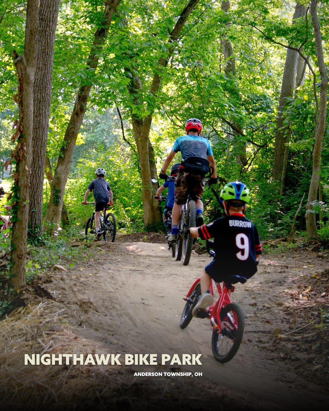
Nighthawk Bike Park (Anderson Township, OH): Located at Nagel Middle School, Nighthawk is a public skills area with wood features for beginners and kids to develop riding skills and have fun.
City of Cincinnati Region:
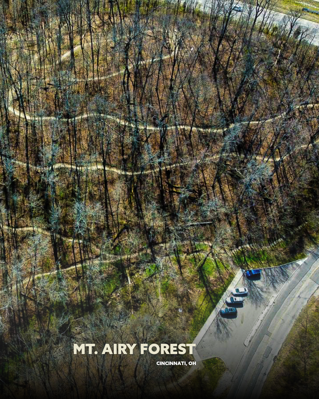
Mount Airy Forest: Home to Cincinnati’s first natural surface trail system within city limits, just off I-74 and minutes from downtown. With nearly 6 miles of multi-use trails, this urban oasis is designed for mountain biking, hiking, and trail running.
Mitchell Memorial Forest: Two loops, roughly 4 miles each, with lots of roots and rocks. One intermediate loop and one more advanced loop with off-camber rocky sections.
Goltra Preserve: Offers multi-use, bike-optimized trails for hiking, biking, and running, designed to connect East Westwood residents to a future trail network linking Mount Airy, Mill Creek, and surrounding neighborhoods, with the first completed trail featuring a scenic ridge-top path, benches, and interpretive signage.
Northern Kentucky Region:
Devou Park (Covington, KY): Just 5 minutes from downtown Cincinnati, Devou offers the region’s longest climbs and fastest descents, with plenty of pumpy flow trails, jumps, berms, and scenic paths for all trail users.
England Idlewild (Burlington, KY): 12 miles of multi-purpose trails with terrain ranging from smooth beginner paths to expert single-track, plus a pump track and bike park.
Tower Park (Ft. Thomas, KY): With tough climbs and descents on the tallest hills in the Cincinnati area, this trail is just minutes from downtown and features year-round open gravel roads for hill-repeat workouts.
Sargeant Park (Dayton, KY): Beginner and Intermediate trails, along with a connective loop optimized for mountain bikes and adaptive use, welcoming all trail users for active, healthy outdoor activities.
Do you use Trailforks and want to save 30% on your annual Pro subscription? Purchase your subscription through this link: https://www.trailforks.com/pro/?aid=127
🛠️ Trail Status: Know Before You Go
CORA employs a real-time trail status system to help you plan your adventure.
✅ Open: Perfect conditions. Go explore!
⭐ Open/Wet: Embrace a little mud; adventure awaits.
🚫 Closed: Too muddy. Let the trail dry out.
🥶 Freeze/Thaw: Frozen? Go ahead. Muddy? Stay home.
Always check the Trail Status Report before heading out.
🚧 Ongoing and Upcoming Projects
CORA is continually working to expand and improve the trail network. Current projects include:
Little Miami River Valley Outdoor Recreation Corridor: A collaborative effort to create a multi-use trail linking communities along the Little Miami River.
Clear Creek Bike Park: A planned park aimed at providing accessible recreation for local youth.
Mount Airy Skills Park: Construction of a skills park featuring a perimeter flow trail and ADA-compliant amenities.
For more details on these projects, visit the Current Projects page.
📍 Find a Trail Near You
With 12 trail locations across the region, there's no excuse not to get outside. From the urban landscapes of Devou Park to the serene paths of Stonelick State Park, CORA has something for everyone.
Explore the full list of trails and their current status on the Trails page